I have wanted to see the great Mayan ruins of Tikal since I first heard of them, and Linette has wanted to go ever since she went on a mission to Guatemala. So we were excited to make it there as part of this trip.
As a reminder, Guatemala is in Central America, just south/southwest of Mexico. Guatemala City, Antigua and Lake Atitlán are all in the southern part of the country, while Tikal is way up north, a 90-minute drive from the town of Flores, in the middle of a massive jungle.
The three ways to get to Tikal are (1) a terrible 10-hour bus ride from Guatemala City; (2) a 1-hour flight from Guatemala City; or (3) a 2-hour drive from Belize. We opted for the 1-hour flight.
So on Tuesday, August 16, 2022, we drove from Lake Atitlán to Guatemala City, and boarded a flight for Flores, Guatemala.
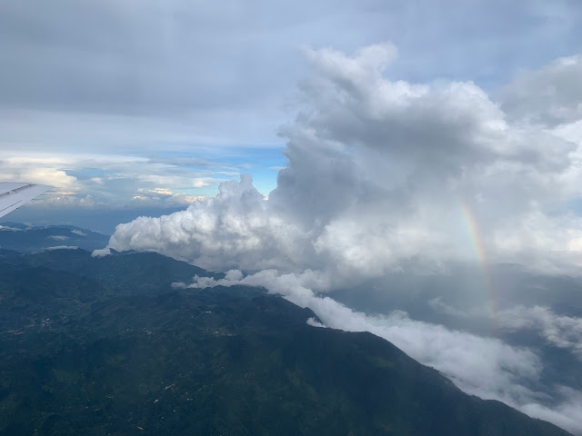
The clouds looked like heaven.
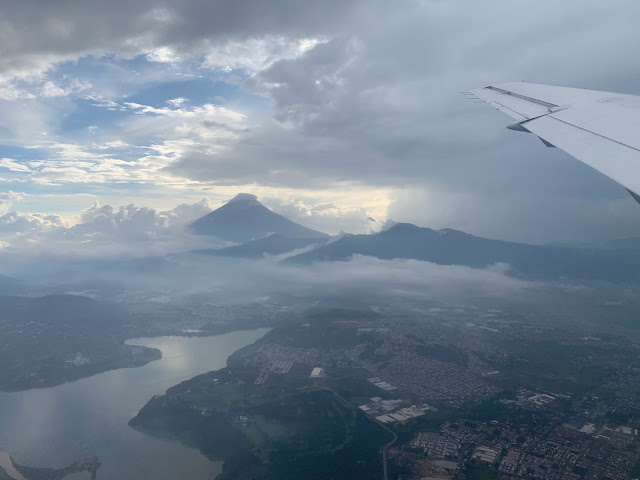
Here is a 45-second time lapse video of taking off from Guatemala City (where you can see a big volcano), flying over the clouds and countryside, and landing in Flores.
The airport in Flores had colorful walls.
At the airport, we were met by our guide, Reyes, and the van driver he had hired. Our plan was to drive to our hotel inside Tikal National Park, do Tikal the next day and sleep there again, and then do another Mayan archeological site of Yaxha the following day before returning to Flores for the night and returning to Guatemala City.
It was handy having this nice van pick us up and take us where we needed to go. We hadn't quite decided if we wanted to pay extra for the "sunset tour" at Tikal, and almost everyone was leaning towards not doing it. But Jared said he wanted to, and I said that I wanted to if Jared did. Sienna, said the same thing. And before we knew it, all 10 of us had decided to do it. So Reyes helped us get these last-minute add-on tickets at a nearby bank, and we were off.
As we drove along, our guide Reyes taught us some things about what we would be seeing, and asked questions to understand our plan and preferences. It soon got dark, and it was interesting driving on this long, straight road that was cut right into the jungle. We passed signs with various animals on them, indicating things like "Jaguar crossing."
We stayed at the Jungle Lodge Hotel, which is located inside Tikal National park, just outside the entrance to the ruins. The reception area and restaurant were both "open air", with no walls separating them from the outside, which allows the breeze to drift through.
This hotel is literally in the middle of the jungle. The electricity is provided by generators, and is only available for certain hours of the day. It turns off from 11pm to 6am, so we were sure to plug in our phones and battery packs immediately upon arrival so they would be ready for the next day.
The hotel porter showed us to our little cabin, and then we walked back to the open-air restaurant where we had some surprisingly good food.
The walk back to our room was eerie, knowing that just a few feet in every direction was solid jungle with who-knows-what lurking out there. (Jaguars...?)
In this 10-second video clip, you can hear the insects as Sienna and I walk through the dark to our room.
It was hot and extremely humid, so we all slept on top of our beds, and I remember the power cutting out (at 1 a.m.), at which point the ceiling fans stopped blowing. There was not enough electricity for air conditioning there.
Meanwhile, the Kartchners stayed at the Jaguar Inn next door (where they had a good arrangement for their larger group).
We all heard howler monkeys early the next morning while it was still dark. I'm glad Reyes gave us a heads-up about that, so that we didn't think horrifying monsters were roaming the jungle. They pretty much sound like Jurassic Park dinosaurs.
Apparently Roger & Sharon had a hammock at their place.
Tikal
On Wednesday, August 17, 2022, we ate a nice breakfast at 6am and joined up with Reyes at about 7am so we could get going on the tour before it got too hot.
Reyes took us to the visitor's center by the entrance to explain a bit about what we were going to be seeing.
Many of the pyramids were originally painted red, and surrounded by large walkways.
The Mayans carved large tablets called steles on which were carved the history and triumphs of their kings. (Pronounced "steel" or "STEELee" in English; or "STEH-leh" in Spanish. Plural, steles, is pronounced "STEELeez"; or some people write it "stelai", pronounced "STEEL-lahy").
This is a picture of some of the coolest steles, which are now in a museum rather than being exposed to the elements. Many of the steles have "long count calendar" dates on them, indicating when they were created. These have been correlated to the Gregorian calendar that we use, so we can get very precise dates for many of these.
Early Mayan agriculture started as early as 1000-400 B.C. in this area, and Tikal was one of the most powerful Mayan cities during the "Classic Period", from about 200-900 A.D. During that time, it had at least 33 rulers that we know of (including at least one queen). The population was up to 100,000 inhabitants.
Plants & Animals
Reyes told us about the animals and plants in the area, in addition to the Mayan ruins.
The Bucute tree (boo-KOO-teh) has pods that taste like chocolate, as confirmed by Sharon and Roger.
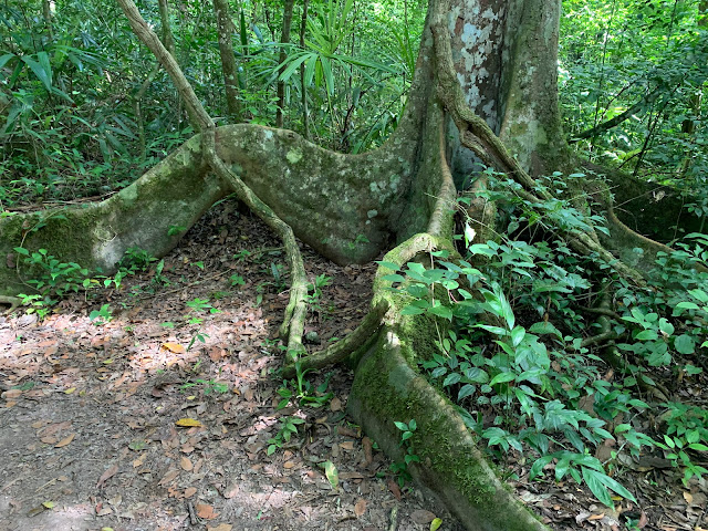
A lot of trees have other things growing on them.
In particular, many trees are surrounded and choked by these parasitic plants. This one is just getting started.
Eventually, they kill and consume the host tree, at which point they are strong enough to stand on their own for a while. Here is one we found where the original host tree was completely gone.
There was quite a bit of wildlife throughout the area.
Luckily, Jared had my dad's Nikon D-80 and its 270mm zoom lens with him.
We stopped to see an amazing Ceiba tree, which was the most sacred tree for the ancient Maya. To them, it symbolized the universe and "communication between the three levels of earth:" The roots were believed to reach down to the underworld, the trunk represented the middle world where people live, and the branches high in the sky symbolized the upper world and "the thirteen levels in which the Maya heaven was divided" (according to thoughtco.com).
Finally, we walked to our first ruins.
Palace of the Grooves
Our first stop was the Palace of the Grooves, or Las Acanaladuras (part of "Group G").
Or maybe it's because we're all so "groovy"!
Reyes said that the logs were added to stabilize the roofs, but that they were not needed originally because the angles made the roof strong enough when the building was completely sound.
This is the "outside" of the "Palace of the Grooves" (also sometimes called the "Palace of the Vertical Columns").
Here are some tiny mushrooms.
We took a bunch of video of monkeys throughout the morning. I compiled a 3-minute video that shows some spider monkeys, the sounds of howler monkeys, and then the actual howler monkeys (not howling at that point). Feel free to watch as long as you're having fun.
Sometimes we saw cool things that weren't really listed on the maps.
Temple V
The jungle still covers the back of Temple V.
Some work is currently continuing over on the right side of the pyramid, under a protective tarp.
South Acropolis
We walked by the "South Acropolis" (Acrópolis Sur). They have done enough little sample digs to understand its shape, but it has not been uncovered. Many structures are purposely left buried to preserve them.
Plaza of the Seven Temples
Next we visited the Plaza of the Seven Temples (Plaza de los Siete Templos), named for the row of seven small temples there.
Ants
One of the things I found fascinating at Tikal was the ants. Here is a big ant colony (I wouldn't recommend walking through there...)We mostly saw leaf cutter ants, where some big-headed cutters would cut the leaves, and smaller ants would carry them back to their colonies, where they would be used to cultivate fungus, which is in turn used to feed the larvae. The adult ants feed on the leaf sap.
One thing that amazed me was the little "roads" that the ants created. They apparently clear out debris along their main path, and you could see these paths go off into the jungle. Once I noticed one, I started seeing them everywhere. And made sure I didn't stand on one.
Here is a 1-minute video showing leaf cutter ants carrying their leaves (and ducking under a branch when needed). Also, it shows the little subtle trails that they carve through the jungle.
Here is a picture of a structure before it was excavated.
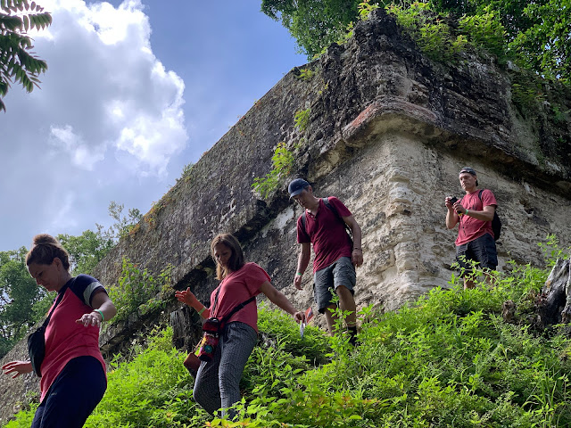
And here is our whole group sitting on it now. In both pictures, you can see a fallen stele and the traditional circular stone altar in front of it.The steps are dangerously steep, so we were very careful, especially when going down. Reyes taught us to have two feet and a hand touching on the way down, and to lean towards the stairs.
Sharon mentioned that she liked how the corners of this structure were a different shape than elsewhere.
This picture shows how one of the structures appeared as it was excavated from 2004 to 2010.
Then we headed through the jungle some more.
We took a little break at an area with a restroom and with some sodas for sale. I liked how the restrooms pretended to have Mayan glyphs for the "hombres" and "mujeres."
Soda in Latin America tends to use real sugar instead of corn syrup, which makes them taste better. Plus, when it's hot and humid outside, they're amazing.
This diagram at the rest area shows how some of the temples were placed so that from a certain spot on a larger temple, the sunrise would just perfectly shine from one or the other corners on the summer solstice (June 21) and winter solstice (December 21), and rise perfectly up the center of another temple, aligned with a couple of steles, on the equinox on March 21 and September 21.
As Sharon recalled for me: "The dynastic ruler would stand on the pyramid and see how it lined up with the temples. He would then know not only summer and winter solstice and the equinoxes, but when to burn fields, plant crops, harvest, etc. The people considered him as something of a deity, since he could basically foretell the weather."
Grand Plaza
It's pretty dope.
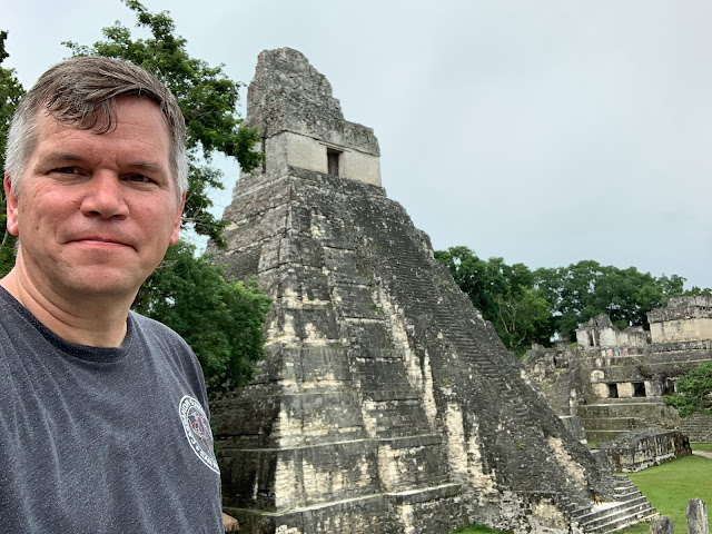
Here is our whole group in front of Temple I.
I'm sure Jason appreciated this particular shot.
To the left of Temple I is a row of steles, and behind that is the North Acropolis, where many of the Mayan royalty were buried.
I loved seeing the Mayan gals in their traditional Mayan clothing here among the ruins of their ancient people.
On the opposite end of the Great Plaza from Temple I is Temple II, which I'll come back to in a bit.
Here are the Mayan gals looking at a map of Tikal while standing in front of Temple II.
In this panorama, you can see us standing in front of Temple II on the left, AND in front of Temple I on the right, with the North Acropolis in between. (Magic!)
We went up to take a closer look at the steles.
Some of the nicer ones are under a cover to protect them from the weather.
This one has a king with a big head dress on it.
One side one this stele is covered with Mayan glyphs. Each glyph is written in a square, and the glyphs are read left-to-right, top-to-bottom, with two glyphs per row. So this stele has three columns that are each two glyphs wide. On some glyphs, you can see numbers from 1 to 19 made up of dots (representing "1") and bars (representing "5"). (There is also a glyph for "zero", so the Mayans were one of the earliest civilizations to come up with that). For example, about halfway down the left side, you can see one with 3 dots and two bars = 3 + 5 + 5 = 13. They use a "base 20" system, so a number like "2022" would be represented with 3 glyphs: a 5 (x20x20=2000), a 1 (x20=20) and a 2 (x1=2), for a total of 2000 + 20 + 2 = 2022.
There used to be thousands of paper books called "codices" with Mayan writing on them, but the Spanish burned all of them, except for four that have survived. They also banned the use of the Mayan glyphs, so eventually nobody in the world could read them.
However, eventually people figured out the numbers (which you can now read, too!), and also their complex "long count" calendar, which starts on August 11, 3114 B.C. According to this Mayan calendar converter, the day we were there, August 17, 2022, has a long count date of 13 baktun, 0 katun, 9 tun, 14 uinal 6 k'in, as shown with the following glyphs. Can you see the 13, 0, 9, 14 and 6 in there?
In front of many steles is a circular stone that served as an altar, often with carved decorations like this one.
Here is a 1-minute video of Reyes explaining a few of the glyphs on a stele that we were looking at, to give you an idea of how they work.
Other more worn steles (with altars) are out in the open.
North Acropolis
Next we explored the North Acropolis, which is a cemetery for the rulers of Tikal. Many royal tombs have been discovered there, and one author (Montgomery) called it Tikal's "Valley of the Kings." Along with the "Lost World" complex (which we visited later in the day), this area appears to have been the most ancient one. It contains evidence of settlers from as early as 800 B.C., and has had rulers buried there from 1 A.D. to 500 A.D. One woman of the noble class was buried there in 100 B.C. and was found with jade, paintings of wealthy nobility and other rich items.
The first version of Temple 22 was build about 250 A.D., a second version was built over that in 350 A.D., and the final version in the 400s A.D.
Often a structure was expanded by building up over the top of it, which is often how sections underneath were so well preserved.
For example, on the North Acropolis, under a protective roof, there is the Mask of Chac, the Mayan god of rain. It was under an upper layer, which preserved it from the elements and the jungle.We had a nice overview of the Grand Plaza from up there, with Temple I on the left...
...and Temple II on the right. (Incidentally, the temple numbers were simply assigned in the order they were found, so the numbers don't reflect when they were built or anything).
We got to climb all over the North Acropolis.
Temple II
Next, we climbed Temple II, which we had been seeing on the west end of the Grand Plaza.
Temple II is also known as the Temple of the Mask. This temple was built in 700 A.D. on the orders of Kasaw Chan K'awil. According to the glyphs deciphered there, he built it for his wife, Lady 12 Macaw. Her marriage to K'awil formed a political alliance between Tikal and the Mayan city of Yaxhá (19 miles away, which we happened to be visiting the next day).
Temple II is 38 meters (125 feet) tall. It appears to have been designed to be taller, but it looks like construction stopped after the first three levels, and the shrine was built at that point instead of continuing upwards.
Reyes took a picture of us up on Temple II.
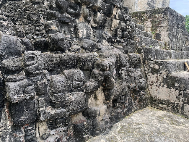
No text (glyphs) survived on this temple, but there are figures carved into the temple next to the steps.
From up there, we could see the tip of Temple III and Temple IV.
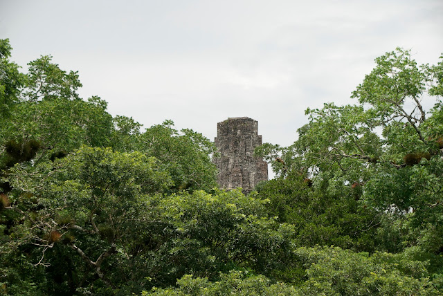 |
| Top of Temple III, from Temple II. |
 |
| Top of Temple IV, from Temple II. |
Then it was back down the stairway in the back of Temple II.
Temple III
Although we had seen the exposed top of Temple III from the top of Temple II, the rest of Temple III is not actually excavated, so aside from a bit of an exposed wall, all we could see was jungle.Reyes told us that there was a beautifully carved wooden lintel (beam of wood above the doorway) here originally, but an early explorer cut it out and now it is housed in a museum.
Temple IV
From near there, we could also see the top of Temple IV, which was our next stop.
We could also see the top of Temple III.
Without a zoom lens, Temples I, II and III looked more like this. Way to the left is Temple 22 that we climbed on earlier, and on the far right is The Great Pyramid of the "Lost World" complex.
Fun fact: This is also the site of the rebel base in Star Wars: A New Hope (Episode IV, i.e., the original Star Wars). It was filmed from right here on top of Temple IV! In this picture, you can see the Millennium Falcon flying to the right of Temple III, which is where it landed.
I apologize deeply for not staging a reenactment photo at the time, but here is a video showing a few scenes from Star Wars in which ships fly in and out of Tikal.
We could also just see the tip of Temple V.
It was cool looking down on the jungle canopy from above with these temples peeking out.
Temple IV is also known as the Temple of the Double-Headed Serpent. It was built in 740 A.D. by Yik'in Chan Kawil, the son of Lord Jasaw Chan K'awil (who Temple I is dedicated to).
While we were up there, a coati paid us a visit and licked something off of the stone.
There was originally a wooden lintel across the top of the doorway into the shrine at the top of Temple IV. It was removed and now resides in a museum in Switzerland. The lintel of another temple is in the British museum.
At that point, we had seen a lot of cool stuff, and it was after 1pm, so we decided to head back to the hotel and break for lunch for a couple hours.
On the way back to the entrance, we passed through the Grand Plaza again, approaching first from behind Temple II.
We also walked through the ball game court adjacent to Temple I.
And we saw people on top of the Central Acropolis, which we would explore in more detail after lunch.
Finally, we saw the ruins of the baño de Vapor (steam bath) on our way through the short cut.
We arranged to meet Reyes at 3:30, and went to the hotel for lunch.
We were pretty sweaty after hiking and climbing in the hot humid jungle all morning, so Linette skipped lunch and went for a swim. Part of the reason we had chosen this hotel was specifically so we could take a swim in the afternoon, so I told Jared what to order for me, and I went and joined her in the pool as well. It felt SO NICE!I missed the soup, but returned in time for the rest of lunch, and it was delightful.




















No comments:
Post a Comment