After a long, intense day at Tikal, we decided to sleep a half hour longer than we had originally planned, and then have a breakfast all together at the Jungle Lodge. Reyes had slept in a hammock in the inexpensive camping area at Tikal (and had to move his hammock a time or two when the pouring rain started leaking through the thatched roof of his camping spot). We invited Reyes and also our driver Byron to join us for breakfast, which they appreciated.
As with all the other food there, the breakfast was great.
After breakfast on the morning of August 18, 2022, we piled into the van and drove towards the Mayan ruins of Yaxha.
She also mentioned how it was a death drap.
Yaxha
The ancient Mayan city of Yaxha is about 19 miles (30km) southeast of Tikal, as the toucan flies, though the drive is quite a bit longer than that. It was inhabited from about 600 B.C. to around 900 A.D. It is the 3rd largest set of ruins in Guatemala, after Tikal and El Mirador (way up north by the Mexican border). Yaxha and Tikal were allies, at least for a time, due to the marriage of the ruler of Tikal to a wife from Yaxha, for whom Tikal's Temple II was built.
The name "Yaxhá" (pronounced "yosh-HAH") means "blue-green water", probably because of the adjacent lake, and comes from the Maya "Yax", meaning "blue-green", and "ha", meaning "water". I like to think of it as "Aqua-Agua". It is one of the few place names of ruins that is the same as the original Mayan name. (The Mayan name for Tikal, by contrast, is "Yax Mutal").
The site consists of several plazas and architectural groups linked by causeways, as well as a causeway down to the lake. The population has been estimated at about 40,000 people (about half the size of Tikal).
There are over 500 structures, including at least 40 stelae. This stele shows a leader in a fancy headdress. You can see his two feet at the bottom left; and I recognize a "9" halfway down on the left side (four dots and a bar).
Minor Astronomical Complex (Plaza C)
This first causeway was called the "Causeway of the Quarries", also known as the "Lincoln Causeway".
South Acropolis
The South Acropolis had two ball courts. Here you can see steps leading up to an observation area of one of them.
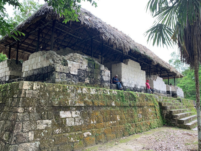
Here we have a couple of people in each of the doorways. The rooms have "corbel vaulted" roofs, made from having long, flat stones be longer and longer until they finally meet in the middle. They apparently had not figured out the stronger curved arches.
The South Acropolis was built in the "Late Pre-classic" period (100 BC-400 AD), and ran through the Terminal Classic period (after 900 A.D.). Yaxha apparently waited a bit longer than Tikal and much of the rest of the Mayan world before it, too, was abandoned around 950 A.D.
This structure was a little further away in the "southwestern group".
This causeway goes all the way down to the lake.
Linette loved this cool tree.
Major Astronomical Complex
Our next stop was the Major (i.e., larger) Astronomical Complex, which is one of the oldest complexes in Yaxha. During the earliest times, this was the main plaza of the city.
The two smaller sanctuaries to the north and south of the main pyramid are at close to a 23 degree angle from the center of the Great Pyramid, and are associated with the location of the sun during the summer and winter solstices.
We hiked up all those stairs to get to the top. Some of the gals knocked on the hand rails on the way up, which sounded a bit like jungle drums with the different pitches that it made.
When we arrived (huffing and puffing) at the top, we were treated to a nice view of the surrounding area, including Lake Yaxha.
Jared zoomed in on Temple 216, "The Temple of the Red Hands", where we would be finishing our trip.
He also zoomed in on Mikayla's face.
This tree is a "chakáh" (chah-KAH"). The locals also sometimes call it a "tourist tree", because the bark turns red and peels, like a sunburned tourist.
This caterpillar wandered along the railing.
And Mike took a picture of this frightening creature, which looks like a cross between a spider and a crab.
Whew. I expected much worse.
We also discovered an inch worm. I guess I had never seen a real one before, because it looked very odd to me. Here's a 30-second video of it (the first 5 seconds give you the main idea).
We also saw some howler monkeys eating in the trees from up there.
We passed by the West Residential Group (Grupo Residencial Oeste), where many people used to live.
Sharon saw this orange centipede, similar to one we saw at Tikal.
Here you can see an inner tree that has been consumed by an outer one.
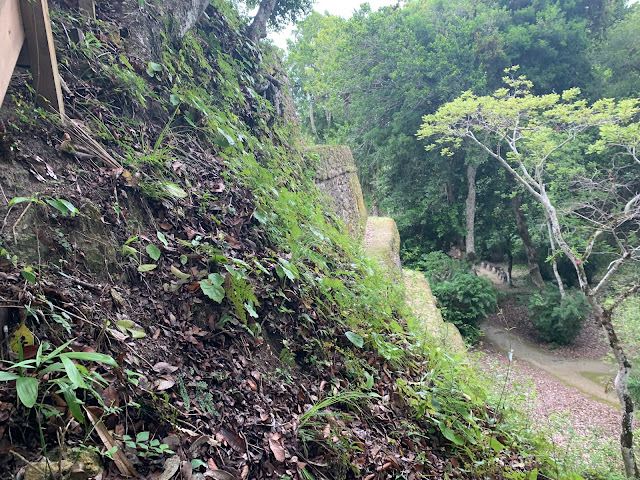
We walked to the north end of the park along the "Waterway Road" (Calzada da las Aguadas), also called "Calzada Blom". It was a wide causeway that leads to a cluster of structures called "Maler's Group" (named after Teobet Maler, who first rediscovered Yaxha in 1904). The causeway has raised walls on each side, and some notches like you see in the picture below. This allowed the causeway to gather rainwater and direct it through those notches into some ponds and water holes for later use.
The causeway was really wide, which supported all the people and their wares who used it, and also, I assume, provided more surface area for water collection.
Here is Jason on the left side.
This 10-second video shows the walls on the two sides. I don't mention it, but you can see the gap on the right side where the water went through into a collection pond.
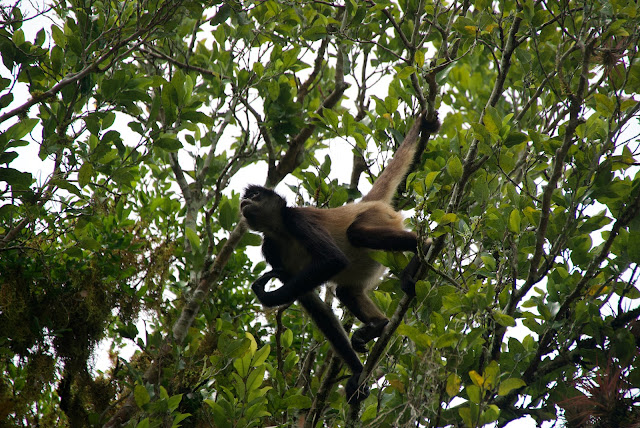
We saw some spider monkeys swinging through the trees.
In that area, I saw some leafcutter ants bringing pieces of leaves down from a tree (to use in nurturing fungus to feed their larvae). As in Tikal, these ants made a "road" through the jungle, but in this case, their path cuts through some grass, so it is much more obvious. Here's a 45-second video showing the ants and the road they carved.
Roger also saw these red ants zooming along. When I looked closer and stepped through the frames, I saw that a little black ant came out of a hole, and one of the red ants sort of bumped into it, scanned it with its antennae, and then went around it, as the black ant ducked back into its hole. After that, all of the red ants went around the hole, so I suspect one or the other of the ants laid down a "conflict zone" or "dibs" chemical that caused the others to start dodging that area. Here's the 8 second video where all of that went down.
Plaza de los Sombras (Maler's Group)
At the north end of the Water Causeway (Calzada Blom), we arrived at a cluster of structures at the Plaza de los Sombras (Plaza of the Shadows), also called "Maler's Group".
A couple times, Reyes asked if we wanted to climb something, or if we wanted to skip it to pace ourselves, because of other things we would be climbing later. We answered, "We want to do it ALL!" :)
People didn't always have the same energy level, of course. This picture from Tikal illustrates the Three Degrees of Energy.
 |
| Shaylee, Mikayla and Sharon with varying levels of energy. (In front of Temple I of Tikal). |
But everyone seemed to be game for climbing on All of The Things, since that was one of the funnest parts.
I'm still thinking Sharon had more than her share of energy, though. :)
From there, we saw some more spider monkeys feeding in the trees.
After hanging out on the pyramid for a bit, we carefully worked our way back down.
One stele was preserved under a cover.
It started raining, so everyone put on their rain gear. All the kids had dark rain jackets. And for some reason they all decided to stick their ears out of them.
Roger quietly went along with it, too.
North Acropolis
Next we went back to the North Acropolis. Here is the "back" side of the west pyramid (away from its plaza).
Under one of the layers was this carving (which has been carefully re-plastered to make it look more like it did originally).
The walls around that structure had a cool notch in them.
Reyes told us that the three pyramids in the North Acropolis corresponded to the three Mayan "hearthstones" of creation, similar to the triangular three-stone hearth that is at the center of all traditional Maya homes. The lower part of the constellation Orion (the belt and feet) represent the same thing, and the Orion Nebula in the middle of those was interpreted by the Maya as the cosmic fire of creation, surrounded by smoke.
We climbed the North Temple, which was the largest one in that plaza. Reyes had us zig-zag up to keep to the steps that were in the best condition.
I thought it was fun that Linette had her little backpack she got in Antigua and her Mayan water bottle holder that she got in Tikal. (I call it her "Guaterbottle")
It was an excellent place to chill for a while.
Roger's camera does something where it makes a video out of a bunch of poses or something, so we all did some goofy poses at the very top.
From up there, we could see the top of the Temple of the Red Hands, which we would reach at the end of our visit.
We told the workers that we appreciated their hard work in restoring these beautiful structures. This guy waved as I took their picture.
Plaza of the Birds
Just south of the North Acropolis is Plaza E, "Plaza de los Pájaros", or the "Plaza of the Birds". It was one of the largest urban spaces built in the Late Classic period (600-900 A.D.).
I thought Stele 31 was beautiful. It was laid flat, under a protective roof.
A replica of the stele stands out in front of a structure that hasn't been excavated yet.
My parents gave me and Linette a book about the Maya almost 30 years ago. On the back is a picture of the author and his wife, with their son, David Stuart. David learned to read Mayan glyphs as a kid, published his first paper about it at age 12, and is now one of the foremost authorities on it.
According to an article he wrote in 2019, the stele shows a "richly dressed warrior-king...standing above a diminutive captive." The six glyphs shown below contain a long calendar date of 13 Ix 2 Zac (which, along with a date on the side of the stele puts the date at August 11, 795 A.D.); a playfully "spelled" verb saying "(he) was captured", the captured guy's name, Xu-bu Chahk-ki (aka Xub Caak); and the place where he was captured from: K'an-na-witz-nal-ajaw, which is Ucanal, Guatemala, located 22 kilometers to the south of Yaxha.
The Mayan writing system is fascinating. Like I mentioned before, the Spanish burned all of the thousands of Mayan paper books ("codices") that existed, in order to prevent the worship of other gods, and then banned the use of the glyphs, and eventually nobody remained who could read them.
People started trying to decipher them in the 1800s, and figured out the numbers and eventually the long count calendar system. But the rest remained a mystery. The top expert in the field at the time viciously slammed anyone who contradicted him, including people whose insights and ideas turned out eventually to be correct. He ripped on one guy who was on the right track, and that guy gave up. It was over 50 years later that someone finally rediscovered what that guy had started to figure out. So it was sad that one arrogant guy could slow progress by decades, in spite of some of the other good work he did.
Someone finally counted the symbols and realized that there were about 800 of them. That was far too few to be "logographic" (with one picture per word, like Chinese, which has over 10,000 characters). And it was far too many to be "phonetic" (with letters that correspond to sounds, like English or Spanish). But it was in the ballpark of the number to be "syllabic" (with one character per syllable, like Japanese kana, which has symbols for "ka", "ke", "ki", "ko", "ku", "ma", "me", "mi", "mo", "mu", etc.).
It turned out to be a very artistic combination of syllable symbols and logographic pictures, woven in and through each other enough to make it kind of tricky, but very interesting.
When you've got an hour to spend, I would highly recommend the fascinating PBS documentary on "Cracking the Mayan Code", which appears to be available for free online at https://topdocumentaryfilms.com/cracking-maya-code/. (I also enjoyed the 2-hour version of this same material that appeared as a NOVA special, but I couldn't find that online.)
So it was cool to see stelae with glyphs on them, and to know that most of them could now be deciphered.
We walked along the East Causeway, passing by a major residential zone along the way.
A couple of us ran up to see this broken stele.
This replica of it has blank areas where the missing parts are. But you can tell that there's a guy with a big headdress.
And there are more glyphs down the side. David Stuart could tell you what they say.
East Acropolis: Temple of the Red Hands
Finally, we reached the wooden stairway that led to our final stop, which was Temple 216. It is called the "Temple of the Red Hands," because archeologists found red handprints within the temple.
This is the tallest temple in Yaxha. It is 38 meters (124 feet) tall.
It was a bit of a hike up the stairs to get to the top, but the view kept getting better as we went up.
From the main platform of the temple, you could see Lake Yaxha in the distance.
A wooden platform surrounds the temple at the top.
Here's what it would look like if it were closer. And flying. And being attacked by a giant human thumb.
From the platform, we saw some more spider monkeys, and got our best look at them yet.
The Dr. Seuss stairs split off so we could exit into Plaza A when we got to the bottom.
Then Jared took a picture of me down in the plaza.
While I waited for everyone else to come down, I spotted a toucan eating berries in the palace. This 40-second video shows it pop its head up and eventually fly up into a tree, by which time Sharon catches a little extra footage at the end.
Here is a silhouette of the toucan in the tree.
Here is a 3-and-a-half minute video of the monkeys we saw throughout the day in Yaxha. We saw howler monkeys eating, and then monkeys swinging and leaping through the trees. One funny moment is when you hear Mikayla realize that the nearby pyramid is not that far away, and is not nearly as large as she thought.
Apparently we forgot to feed the Sienna. Fortunately, we were about done and started making our way back to the entrance.
Across Plaza A from the temple was a palace.
Plaza of the Columns
On our way to the entrance, we walked through Plaza B, or "Plaza of the Columns" (Plaza de las Columnas) because of the open building there with seven columns in it.
Only the top part has been excavated, so the hill above is actually part of a tall structure, as shown in the illustration below.
 |
| Stele 11, Plaza B, Yaxha. |
Here is a replica that is easier to see.
 |
| Replica of Stele 11 |
As we neared the parking lot, we saw a deer run by. It appears to be a brocket deer rather than the white-tailed deer we are used to in Utah.
Still, it took me a few hours when writing up this report for me to figure out what we had seen and where it was. I had to use GPS locations on some of our photos, in conjunction with the signs and some other maps I found. I ended up creating the map below in order to finally get it all straight.
We drove to a restaurant that Reyes recommended, and they served a variety of beverages, including a warm drink in a cute earthen mug, a red sweet drink called jamaica (hah-MY-kuh), and Coca-Cola with real sugar.
We all ordered the same chicken dish to make it easy on them.
We said good-bye to Reyes and thanked him profusely for taking such good care of us, and helping us to have such a great experience at Tikal and Yaxha.
Reyes had told us about his girlfriend from England, and we were excited to get to meet her.
We were pretty sure that the elevator at the hotel could handle this many people at once.
Due to some faulty information from our AirBnB at Lake Atitlán, and our tight schedule afterwards, we had not really been able to do laundry yet on our trip. With hot, humid days and lots of hiking around, that was becoming worrisome. Linette and I walked around town with a bag of laundry to see if any of the laundry places would do it, but they were all about to close and didn't want to do a load for us, so we gave up and went to go join everyone else.
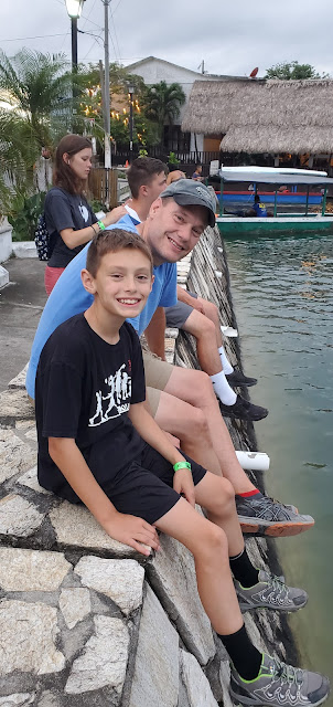
They were all hanging out by the lake. Here Jason is pretending to fall in.
The little island had a party atmosphere, with colorful things in the air and music playing.
Everybody went to get ice cream cones, which you could get dipped in chocolate, which I always appreciate.
Linette and I finally joined them, and I went down and ordered a cone, too, doing my best in Spanish to make sure I ended up with ice cream. I was kind of grumpy from the laundry fiasco, and a little grumpier still when half the chocolate fell off my cone, got my shorts all dirty (did I mention we couldn't do laundry?) and fell in the water, at which point dozens of little fish showed up immediately to eat it. But you can only be so grumpy while sitting in a beautiful place at the end of a wonderful day with great people while eating ice cream, so I chose to get over it.
We stayed out until it got dark, and then went and played a couple games in our hotel room before finally passing out.















No comments:
Post a Comment