
Santiago de Compostela
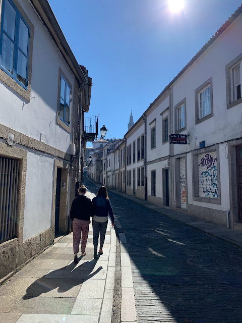
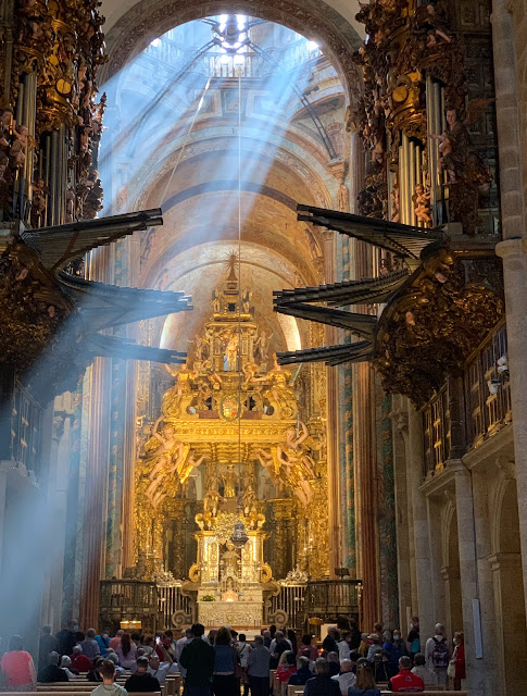
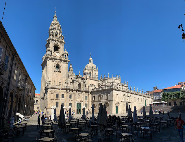
After about an hour, we reached our first destination that day, Santiago de Compostela, which is the capital of Galicia.
Every year, about 200,000 people make a pilgrimage along the Camino de Santiago (or "Way of St. James"), to arrive here. Some walk a few days, others walk for several months. Some people do this as a spiritual journey, either alone or in a group; others as a fun hike.
This map shows the network of paths that lead to this Cathedral from all around Europe. Two-thirds of the walkers come from France (on the "French Way"), but other routes are becoming more popular as well.
One of the oldest starting points was Oviedo (along the northern coast of Spain in the above map). You may recall that I took a picture there of one of the scallop shells that marks and represents the path. People used to obtain a scallop shell from the coast after making the pilgrimage, and then used it as a token to show that they had been there. Nowadays people often display a scallop shell on their backpack or wherever during the pilgrimage itself, and markers such as this are embedded in roads or walls along the way.
In 1492, during the reign of Ferdinand II of Aragon and Isabella I of Castile, Pope Alexander II officially declared Camino de Santiago to be one of "three great pilgrimages of Christendom," along with Rome and Jerusalem. So it's a pretty big deal.
In 2022, Sienna I of Utah and Isabel the Great of Parla arrived at the Cathedral and officially declared that it was pretty cool.
On the back side of the cathedral, I saw a group of recently-arrived young pilgrims in yellow T-shirts holding up signs that said "Free hugs!" (some in English, and some in Spanish, "Abrasos gratis").
On the steps in front of the side entrance to the church, Sienna shows the ring she made in A Coruña.
Back around the front of the cathedral, we saw many pilgrims arriving from their long journey. Linette said, "¡Bienvenidos!" to some of them, and they were happy for the welcome. Everyone was so excited!
But since we had a minute, I ran down there and found out!
At that point, we got back in the van and I drove for a couple of hours. Linette and I both got international driver's licenses at AAA to allow us to drive in Europe for the next 12 months. What it certifies is that you paid someone $35 (No training was involved). We had each had a turn driving in Spain so far, with lots of advice as we went to help avoid things like the electronic speeding tickets at certain advertised points.
About 6:30pm, we arrived at Ávila, a small city with great medieval walls, about an hour northwest of Madrid.
Ávila was inhabited in pre-Roman times (5th century B.C.) by some people who called it "Obila" ("High Mountain") and built a strong fortress there. After the Romans conquered it, they turned it into a rectangular town with two main roads that intersected into a "forum" in the center.
There are 9 gates built into the walls around the old city.
Through the first gate we went through, we found the Convent of Santa Teresa, supposedly built on the site where Santa Teresa was born in the 17th century.
One of the local specialties was "Yemas de Santa Teresa", a simple traditional Spanish dessert made of egg yolks and sugar with a powdered sugar coating. ("Yemas" means "yolks").
At that point, we headed to a place where we could climb up onto the city walls.
There was a little museum as we entered where we learned a little of the history of the ancient city.
They had those little windows that archers could use to shoot in various directions with minimal exposure.
They had some displays with cutouts for your hands and silhouettes of various weapons that were used back in the day.
The walkable part of the wall ended at the main cathedral and its flying buttresses.
I could see that the cathedral had stained glass windows that are probably cool, but we didn't have a chance to go in.
The walls looked cool lit up as the sun set.
The puerta del Alcazar (gate of the fortress) looked awesome, especially with the moon just peeking through the arch.
...and the ugly bear. When she saw the picture, she nodded and said, "¡Si!" as if to say, "Fair enough!" (It could be a boar. Not sure).
The moon hung just above the walls.
I asked Nico to drive over to a viewpoint so we could see the city walls at night from there. It was hard to get a sharp picture at night, but I got a few.
Continuing on the map below,
As we walked back towards the car, we got ahead of part of our group, so I dramatically said to Sienna and Isabel, "We will never know what is down that alley."
It turned out to be a beautiful garden area!
And a little old man was hoeing the garden back there. And there was a bridge and a stream. So cute.
We stopped for gas, lunch and ice cream bars and then got back on the road, this time with Nico at the wheel.
As we continued driving, we saw churches and ruins that I thought were interesting.
In the first century A.D., Secundus brought the gospel to Ávila and became its first bishop. Ávila commemorates St. Segundo (now its patron saint) on May 2nd every year.
After the fall of Rome, Ávila became a stronghold for the Visigoths, then conquered by the Moors, and then repeatedly attacked by northern Christian kingdoms, becoming an unpopulated no man's land. Finally, in 1088, after the reconquest by Raymond of Burgundy, the town was repopulated, and the stone walls were constructed that still stand today. So these walls are almost 1000 years old.
We looked in some of the shops as we walked along.
One of the shops there had these cute little things. I don't know what they are.
I noticed that in much of Europe (at least the older areas that we visited), the streets are done in brick or other stone work, rather than concrete or asphalt. It seems like that would let some of the water drain without having to go to the gutters, and it looked wonderful.
From up there, you can look down on the path that follows the main part of the wall.
Arches connected some sections of the wall.I asked Nico how the red ceramic shingles stayed on. He explained that they put cement under each one to glue it on. Then we walked by this spot, and I could see what he was talking about.
Here is the east side of the walls from the corner tower.
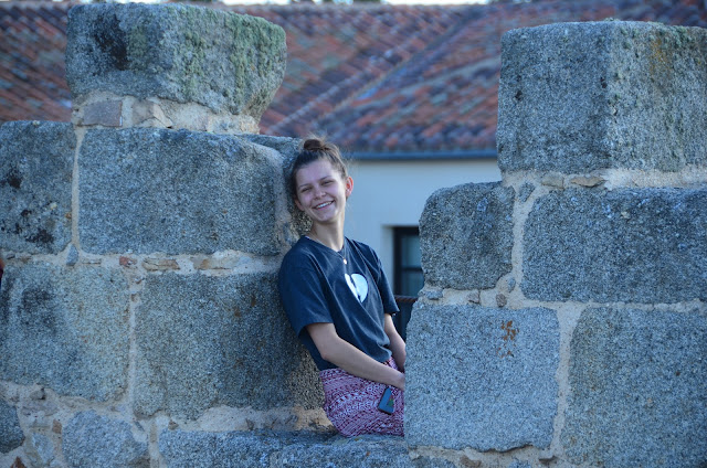
From there, I could get close-ups of everyone from the "outside" of the wall.
And here are these two cuties.
Here is one last look back along the east wall.
While we were eating, a jazz band was playing nearby, which added some fun atmosphere.
After dinner, I went to go see if the ice cream place had closed. Indeed it had not.
I walked through one of the gates while we were waiting for someone and took a quick look around. Afterwards, Mari asked what I had seen.
"Yo vi una fuente bonita..." (I saw a pretty fountain), I slowly began, as Mari nodded; "...y un oso feo," (...and an ugly bear), I concluded, as Mari looked surprised.
So I showed her the picture of the pretty fountain...
We got led astray by our GPS app on the way home, but eventually made it back to the apartment in Parla.
What a week!
Here are two maps showing the places we went on our tour of northern Spain.
- We hit Toledo (the southernmost yellow star) before we started the northern route.
- Segovia is just up from Madrid.
- We stopped in Campille (up towards Valladolid).
- Then up to León and Oviedo.
- Then over to Ruta del Cares in Picos de Europa for the day, and back to Oviedo.
- From Oviedo over to As Catedrals beach (Spanish: Playa de Las Catedrales).
- Then on to A Coruña for two nights.
- Then down to Santiago de Compostela.
- Then across and down to Ávila.
- Then finally back to Parla.
You can see in the map that the area we were in tends to be green, and it was so beautiful! We drove about 20 hours total, and we were so thankful to the friends of the family who lent us the minivan for the trip.














No comments:
Post a Comment